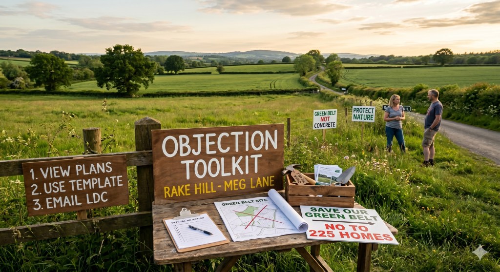
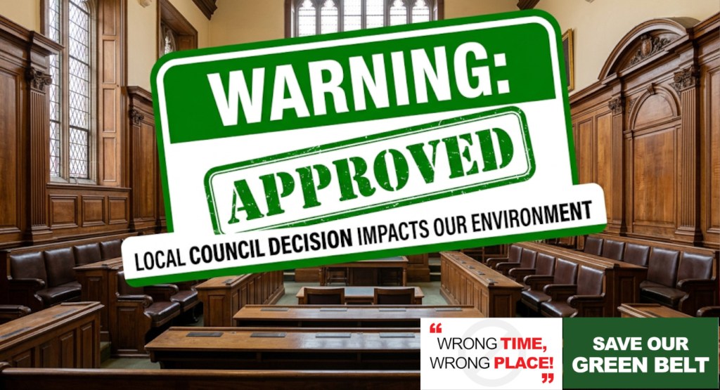
The community is fighting the unsustainable proposal by Hourigan Planning and Anwyl Land to build 225 homes on the green corridor between Rake Hill and Meg Lane.
While the developers have claimed they’ve had “positive discussions” with Lichfield District Council, we have a major advantage.
We have unearthed the official historical planning registry for this exact piece of land. The development on this site has been attempted—and soundly defeated—before.
Below is your comprehensive Objection Toolkit. It contains the exact legal precedents we need to use, along with a copy-and-paste template you can send to Lichfield District Council planning department.
Our Secret Weapon: The Historic Legal Precedents
We have uploaded two crucial documents that everyone needs to reference. (Click the title to read the documents):
- “Planning decision 11_00496_COU–323971.pdf” (Lichfield District Council’s original refusal)
- “Appeal Decision..pdf” (The Government Planning Inspector’s dismissal of the subsequent appeal)
The “Horse vs. Housing” Rule of Logic
In 2011, an application was made for a simple change of use to keep horses on this exact land. Lichfield District Council refused it, and in 2012, a Government Planning Inspector dismissed the appeal.
The authorities ruled that just a few horses, plastic strip fencing, and a couple of temporary field shelters caused a “significant and detrimental erosion of the openness and visual amenity of the Green Belt” and were “harmful to the amenity of the Green Belt”.
Our argument is simple: If a few horses and temporary field shelters are legally recognised as destroying the Green Belt and harming this landscape, then pouring concrete for 225 suburban houses, access roads, and streetlights is completely indefensible under the exact same planning laws.
Here are the three specific legal pillars from “Appeal Decision.pdf” and “Planning decision 11_00496_COU–323971.pdf” that we can use to dismantle the developer’s new proposal:
1. Severe Highway Danger on Meg Lane
The developers are proposing a primary vehicular access point onto Meg Lane.
- The Legal Fact: In “Planning decision 11_00496_COU–323971.pdf”, the council refused the application because the traffic “would be likely to result in an increase in highway danger owing to increased use of the existing access which affords restricted visibility for drivers”.
- The Inspector’s Ruling: In “Appeal Decision.pdf”, the Government Inspector explicitly agreed, stating: “The existing access to the land south of Meg Lane is on a bend with poor visibility… it is unsatisfactory from a highway safety point of view”.
- How to use it: The physical geometry of that bend and the restricted visibility have not changed since 2012. If the road was deemed too dangerous for a few horse owners, it cannot legally or safely accommodate the hundreds of daily car journeys generated by 225 houses.
2. High Scenic Value vs. “Grey Belt” Claims
The developers are attempting to downplay the quality of this land, aiming to classify it as “Grey Belt” to exploit loopholes in national planning policies.
- The Inspector’s Ruling: In “Appeal Decision.pdf”, the Planning Inspector completely validated the high environmental worth of this exact site. He stated that the land “forms a buffer of open countryside between the urban area and the nearby boundary of the AONB”. He explicitly added that “the land is of considerable scenic value in its own right, and the effects should be judged accordingly”.
- How to use it: You can quote the Inspector directly to prove that this site is a recognised, highly valuable scenic buffer protecting the Cannock Chase Area of Outstanding Natural Beauty (AONB). It is not low-value “Grey Belt” land.
3. Destruction of Residential Amenity
The original applications were heavily defeated because of the negative impact on the living conditions of immediate neighbors, such as those at Castle Farm.
- The Inspector’s Ruling: In “Appeal Decision.pdf”, the Inspector noted that the elevated nature of the site allowed “extensive overlooking” and caused an “unacceptable degree of noise and disturbance… well beyond what would be considered reasonable in a predominantly rural environment”.
- How to use it: If the minor noise of a few people grooming horses was legally deemed an “unacceptable degree of disturbance” to local residents, the chaos of a multi-year housing construction site and a dense housing estate will permanently destroy the residential amenity of neighboring properties.
📋 Copy-and-Paste Email Template – Do This TODAY!
Below is the strategic blueprint for your email to Lichfield District Council.
⚠️ CRITICAL STRATEGY WARNING: Make It Your Own! If the planning department receives dozens of identical, carbon-copied emails, they are legally allowed to bundle them together and count them as one single petition. We cannot let them downplay our numbers.
To ensure your voice carries maximum weight and your submission is logged as a completely independent objection, do not just copy and paste this blindly.
How to make your objection count legally as an independent voice:
- Tweak the text: Rewrite a few sentences in each section using your own words.
- Add a personal paragraph: Insert a few lines about how this project directly impacts you. Mention your daily commute down Megs Lane, your specific experiences trying to get an appointment at the local GP surgery, or how long you’ve lived near the Rake Hill green corridor.
Let’s make sure every single email hitting Gillian’s inbox is a distinct, powerful legal argument.
Send Your Email To: neighbour.responses@lichfielddc.gov.uk
Subject: OBJECTION: Outline Planning Application 26/00630/OUTM – Land Between Rake Hill and Meg Lane, Burntwood
Attn: The Case Officer (Gillian Pinna-Morrell), Planning Department
Regarding: Formal Objection to Outline Planning Application 26/00630/OUTM for a Residential Development of up to 225 Dwellings on Land Between Rake Hill and Meg Lane, Burntwood.
From:
- Name: [Your Name]
- Address: [Your Address]
- Email: [Your Email Address]
Dear Ms. Gillian Pinna-Morrell,
I am writing to formally register my strongest possible objection to outline planning application 26/00630/OUTM for 225 homes on the land between Rake Hill and Meg Lane, Burntwood.
As a local resident, I maintain that this high-density development is entirely unsustainable and inappropriate for this location. My objections are grounded firmly within material planning considerations and the clear historical planning precedents already established on this exact parcel of land by both Lichfield District Council and the Planning Inspectorate.
I request that you fully assess the following material planning arguments against application 26/00630/OUTM:
1. Severe Highway Safety Risks (Meg Lane & Rake Hill Access)
The proposal to introduce the substantial vehicular traffic of 225 homes onto Meg Lane poses an unacceptable threat to highway safety. This exact issue has already been legally tested and confirmed on this specific site. In Lichfield District Council’s previous refusal 11/00496/COU, a low-impact development was explicitly refused because the traffic “would be likely to result in an increase in highway danger owing to increased use of the existing access which affords restricted visibility for drivers”.
Furthermore, in the Secretary of State’s Appeal Decision (Ref: APP/K3415/A/11/2159504), the Planning Inspector explicitly upheld this refusal, ruling that the access “is on a bend with poor visibility” and is “unsatisfactory from a highway safety point of view”. The physical geometry and restricted visibility of this road have not changed since that ruling. If the road network was deemed too dangerous to support the limited traffic of a minor equestrian use, it cannot legally or safely accommodate the hundreds of daily vehicle movements associated with a major 225-home housing estate.
2. Erroneous “Grey Belt” Claims & Irreparable Harm to the AONB Buffer
Any attempt by the developer to classify this parcel of land as low-value “Grey Belt” directly contradicts the established legal character of the site. In the previous Appeal Decision, the Government Planning Inspector explicitly designated this land as a vital environmental and visual asset, stating that it “forms a buffer of open countryside between the urban area and the nearby boundary of the AONB”. The Inspector formally concluded that “the land is of considerable scenic value in its own right, and the effects should be judged accordingly”. Developing 225 homes here would obliterate an officially recognised scenic landscape buffer, causing severe harm to the setting of the Cannock Chase Area of Outstanding Natural Beauty and strictly violating local Green Belt protections.
3. Unacceptable Impact on Local Residential Amenity
The high-density layout proposed under 26/00630/OUTM will severely damage the living conditions of existing local residents through overlooking, noise, and visual intrusion. In 11/00496/COU the council previously protected local occupiers from development that results in a “significant detrimental impact on the amenities of occupiers”. In the Appeal Decision, the Inspector agreed that the elevated topography of the site creates an unacceptable risk of “extensive overlooking of the garden and habitable room windows” and introduces a “degree of disturbance and intrusion which I consider unacceptable”. If a small-scale equestrian use was rejected for disrupting the peace of this rural environment, a massive, multi-year residential construction project and subsequent estate are entirely incompatible with protecting local residential amenity.
4. Severe Surface Water Flood Risk and Impact on the Local Watercourse
The application fails to properly mitigate the risk of surface water flooding. In the previous Planning Inspectorate decision (“Appeal Decision.pdf”), it is noted that this specific site sits directly alongside a local brook course. By covering these natural, absorbing agricultural fields with non-porous concrete, tarmac, and high-density housing, the developer will drastically accelerate surface water runoff. This presents a severe risk of overloading the local brook and flooding adjacent properties and lower-lying areas of Burntwood, directly violating local and national flood risk planning policies.
5. Lack of Sustainable Transport Links and Severe Pedestrian Safety Hazards
The site is highly unsustainable as it lacks safe, accessible pedestrian infrastructure. Meg Lane is a narrow rural road without continuous footways, adequate street lighting, or dedicated cycle paths. Forcing residents from 225 homes—including young children walking to local schools—to navigate a road that the Planning Inspectorate has already legally designated as an unsafe “bend with poor visibility” is a severe highway safety hazard. The proposal fails to provide safe, sustainable design alternatives and forces total automobile dependency on the future occupants, conflicting with the sustainable transport objectives of the NPPF.
6. Failure to Consider Cumulative Infrastructure and Highway Impacts
This application cannot legally be evaluated in an isolated vacuum. The proposed 225 homes are part of a wider, concurrent surge of major residential proposals in the immediate area—specifically alongside substantial applications at Coulter Lane and Highfields Road, bringing the total to 975 proposed homes in Burntwood.
As you are the designated Case Officer for both this application (26/00630/OUTM) and the Coulter Lane (25/01485/OUTM) proposal, you are uniquely positioned to recognise that evaluating these sites independently is a severe planning oversight. The combined traffic from these 975 homes will funnel onto the exact same intersecting local road networks, paralysing local junctions. Furthermore, Burntwood’s public infrastructure is at a breaking point; the local schools, over-subscribed GP surgeries, and wastewater networks cannot absorb this combined strain. In accordance with the National Planning Policy Framework (NPPF), the council must assess the cumulative impact of these overlapping proposals. Given your direct oversight of these cases, I urge you to reject this application as premature and unsustainable until a comprehensive, multi-site infrastructure assessment is conducted.
For these reasons, grounded in established planning law, the extreme cumulative pressure on Burntwood, and the Planning Inspectorate’s own previous rulings on this exact site, I urge Lichfield District Council to refuse planning permission for application 26/00630/OUTM.
Yours sincerely,
[Your Signature]
📢 What to Do Now
- Send the Email: Copy the text above, paste it into an email to neighbour.responses@lichfielddc.gov.uk, fill in your details, ADD YOUR OWN PARAGRAPHS and hit send.
- Multiple people, multiple submissions: You can make as many submissions as you like, they all count (providing they are unique).
- Tell Your Neighbors: Share this updated guide on local Facebook groups, WhatsApp chats, and Nextdoor. Let’s make sure the Case Officer’s inbox is filled with clear, legally grounded objections referencing 26/00630/OUTM that they cannot ignore!

Leave a comment